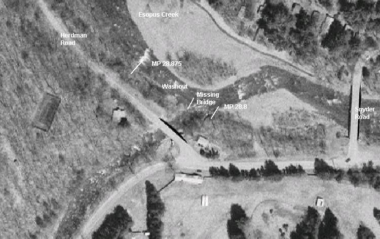
Washout Between MP 28.8 and 28.875This satellite image shows the third and last washout west of Phoenicia. The biggest problem is the missing Woodland Creek Bridge, which was partly washed out in 1987 and has been stored since by the county highway department. There are also about 250 feet of track washed out west of the former bridge location.
You can see from this photo how a new channel for the creek caused the erosion of the ROW.
We plan to clear out the ROW in this area at some point next year to better assess the damage and potential repairs for the railroad. The rails on the west end of the washout lead into the creek, and we would like to remove these damaged rails next year.
Photographed by New York State GIS, April, 2004.
Added to the photo archive by Ernest Hunt, October 31, 2006.
Railroad: Catskill Mountain RR.
» Contact the person who posted this photograph.
 The GreatRails North American Railroad Photo Archive