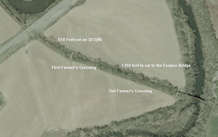
Satellite Image of CMRR clearing of 510 feet of Track on 3/12/06This image, dowloaded from the NYS GIS website, shows our 510 feet of cutting done on 3/12/06 east of 209 (the highway on the left) towards the first farmer's crossing (marked with white line). The next segment to cut, to the first girder on the Esopus birdge (marked with the white line on the right) measures about 1350 feet, and we hope to make progress on this next Saturday the 18th.
Photographed by New York State GIS, April, 2004.
Added to the photo archive by Ernest Hunt, March 13, 2006.
Railroad: Catskill Mountain RR.
» Contact the person who posted this photograph.
 The GreatRails North American Railroad Photo Archive